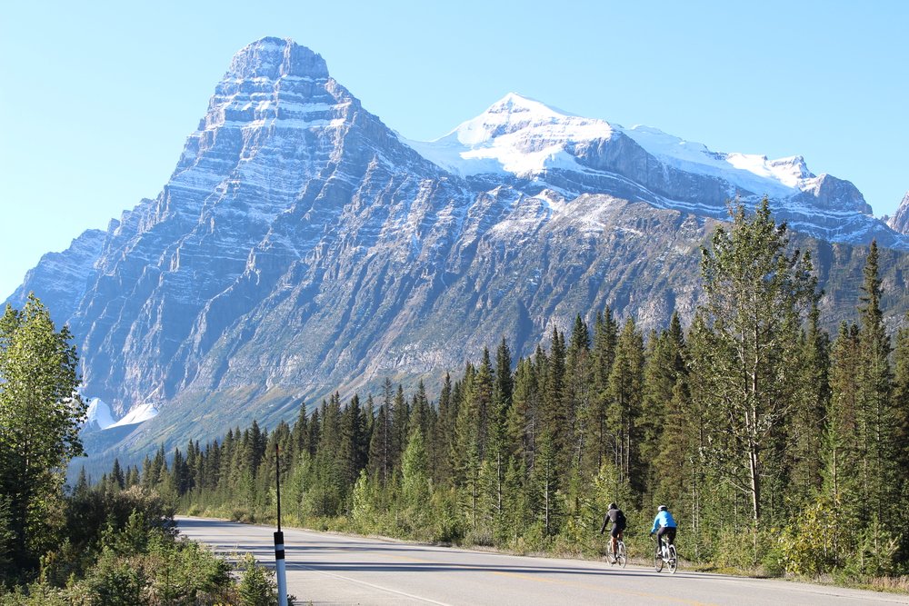
Riders always ask what that mountain was. This page is the answer, in riding order. It follows our four-day itinerary, and each day ends where you sleep that night.
Distances between stops are approximate, and where we stop depends on the weather and the group. One tip for all four days: look behind you now and then. Some of the best views on the parkway are the ones you’ve just ridden past.
Day 1
Jasper to Sunwapta Falls
50 km About 590 m of climbing Route map (opens in a new tab) The guest’s day 1
After the morning drive from Edmonton, the first afternoon is a gentle one: a gradual climb south from Jasper with one bigger hill near the end. It’s a good chance to settle into your bike before the big day.
Leaving Jasper
The first stretch south of town passes through forest burned in the July 2024 Jasper wildfire. Parks Canada puts the fire at about 32,700 hectares of the Athabasca Valley, and it reached the Athabasca Falls area, where the wilderness hostel was lost. The falls viewpoint itself was largely spared. Regrowth starts almost as soon as a fire has passed, and watching the forest come back is part of the ride now.
Look back as you leave town for Pyramid Mountain, the high, even peak above Jasper. Ahead of you is Mount Hardisty, and to the south the snowy bulk of Mount Edith Cavell, named in 1916 for a British nurse executed during the First World War.
The Whirlpool Valley viewpoint
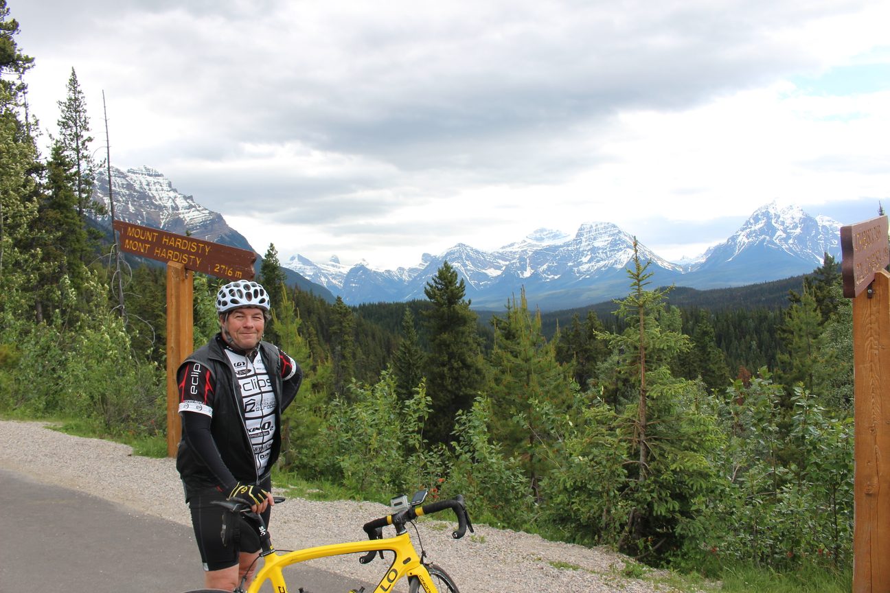
About 25 km in, we regroup at a viewpoint under Mount Hardisty that looks down the Whirlpool Valley. In January 1811 the fur trader David Thompson followed the Whirlpool River up to Athabasca Pass, and for the next 40 years or so it was the fur traders’ main route over the mountains to the Pacific. Mount Hardisty is named for Richard Hardisty, a Hudson’s Bay Company chief factor.
Athabasca Falls, the first rest stop
A few kilometres on is our first official rest stop, at Athabasca Falls. You get a front-row view of Mount Kerkeslin over the falls, and early or late in the season the snow clings to its folded layers of rock. The name comes from James Hector’s spelling of an Indigenous word for wolverine, after his party had a run-in with one at their food cache in 1859.
Goats and Glaciers
Seven kilometres past the falls we pull into the Goats and Glaciers viewpoint, named for the mountain goats that come to lick the mineral deposits on the bank. From here you see Mount Fryatt, Brussels Peak and Mount Christie, with the Athabasca River far below. Fryatt and Brussels share a story: Captain Charles Fryatt commanded the ferry Brussels and was executed during the First World War, and the two peaks are named for him and his ship. Mount Christie is named for William Christie of the Hudson’s Bay Company’s Fort Edmonton, a nice link back to where your tour began.
The last climb to Sunwapta Falls
From Athabasca Falls it’s about 26 km, mostly uphill, to Sunwapta Falls, with a final push up to the lodge. After dinner, walk the short path to the falls. The Sunwapta River, fed by meltwater from the Athabasca Glacier, pours through a narrow limestone gorge, and in the evening the day visitors have gone home.
Day 2
Sunwapta Falls to The Crossing
98 km About 1,030 m of climbing Route map (opens in a new tab) The guest’s day 2
The big one, and the day most people remember. It’s what I call updulating: rolling, but trending up all morning, from Sunwapta Falls to the Columbia Icefield and over Sunwapta Pass. After lunch comes a long descent, then rolling hills to The Crossing.
The Endless Chain and the Jonas Creek rockslide
From the start there’s a long, even ridge on your left, the Endless Chain. You’ll only see how long it is when you look back from the first rest stop. About 20 km in, you ride through a rockslide where the rubble on both sides of the road is pink and orange from iron oxide. Trees still haven’t grown back over it.
First rest stop: Mushroom and Diadem peaks
About 30 km in, we stop at a viewpoint facing Mushroom Peak and Diadem Peak on the right, with Sunwapta Peak on the left. Diadem is named for the crown of snow that J. Norman Collie’s party found on its summit in 1898, and Mushroom for the dark, mushroom-shaped rocks on top.
Tangle Falls and the big bump
The big ridge in front of you fills your view for the next 8 km. You’ll climb past Tangle Falls, one of the most photographed waterfalls on the parkway, and the people at the bottom of the falls often turn around to cheer you on. Then there’s a rare flat stretch before the main challenge of the day, a climb of about 3 km that we call the big bump.
Less than a kilometre into it, we wait at the Stutfield Glacier viewpoint for photos and encouragement. Rest up and take in the view, or hop in the van for a lift to the top. Nobody minds. The glacier spills in two icefalls down Stutfield Peak, named by Collie for his climbing partner Hugh Stutfield.
Halfway up, look right. The near-vertical wall capped with ice is Mount Kitchener. Collie called it Mount Douglas; it was renamed in 1916 for Lord Kitchener, the British field marshal.
Lunch at the Columbia Icefield
After the climb there’s a short, sharp downhill, then gently rising flats to the Columbia Icefield, where we stop for lunch. Expect a cool headwind off the glacier. On your left, Wilcox Peak drops a slope of scree and big boulders almost to the road. It’s avalanche country in winter, so it’s not a place to linger.
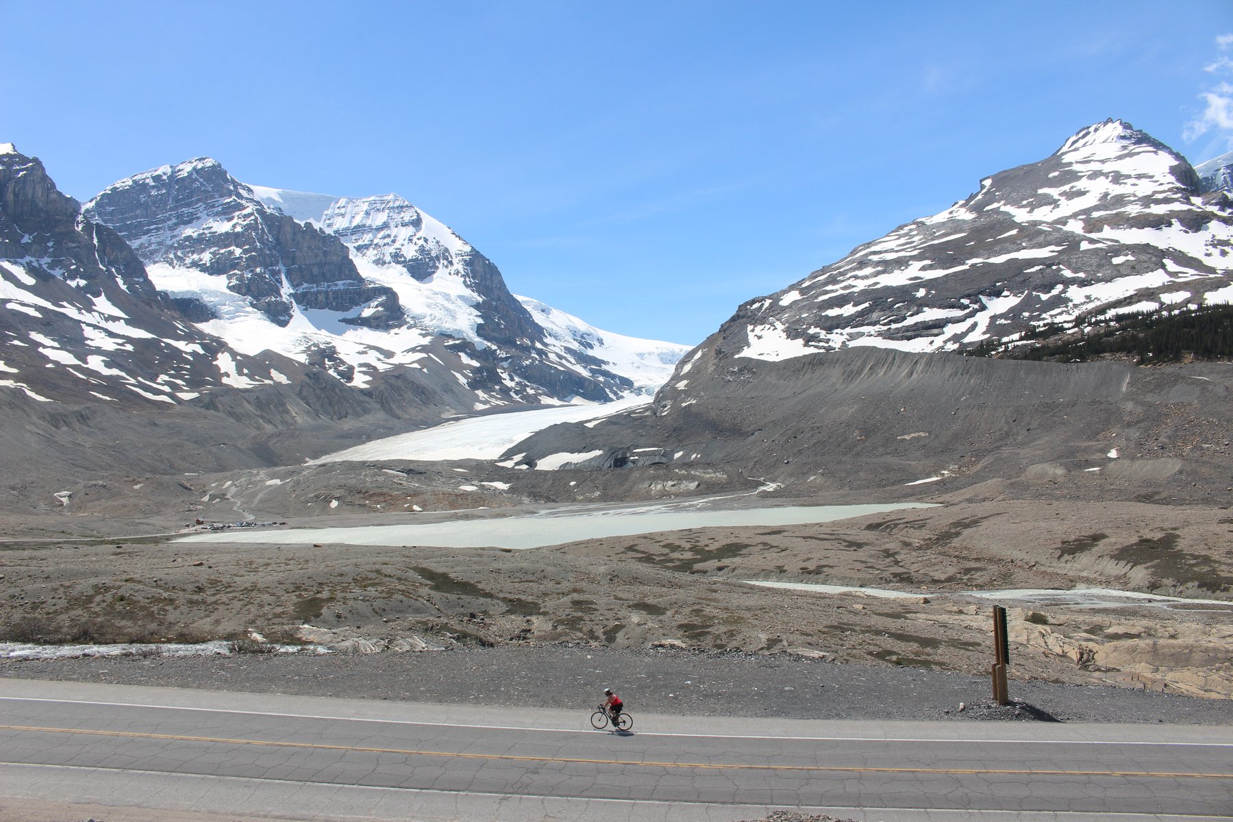
At lunch you’re surrounded by ice. The Athabasca Glacier is the famous one, flowing down from the icefield over three giant steps of bedrock. Just to its right, the Dome Glacier pours off Snow Dome, and I think it’s the more spectacular of the two. Parks Canada notes that meltwater from Snow Dome reaches three oceans: the Pacific, the Arctic and the Atlantic.
The Columbia Icefield covers more than 300 square kilometres and is the largest icefield in the Canadian Rockies. It is also shrinking. Parks Canada says the Athabasca Glacier has been receding for about 125 years and now loses about 5 metres a year, and 2023 brought its biggest melt in a decade. Between 2017 and 2024 the whole icefield lost about 1.5 cubic kilometres of ice. The rocky moraines around the glacier’s toe are the ground it has given up.
If you walk out toward the glacier, stay on the marked paths. Parks Canada warns that the ice is unstable and that people have died falling into hidden crevasses.
Across the flats rise Mount Athabasca and Mount Andromeda. In 1898 Collie and Hermann Woolley made the first ascent of Mount Athabasca and looked west over the icefield. “A new world was spread at our feet,” Collie wrote.
Over Sunwapta Pass
After lunch there’s one last gentle climb of about 5 km to Sunwapta Pass. At 2,035 m it’s one of the two high passes on the tour and the boundary between Jasper and Banff national parks. Water on the north side runs to the Athabasca River; on the south side it joins the North Saskatchewan. The southeast summit of Nigel Peak towers over the road as you climb. Collie named it for Nigel Vavasour, one of his packers.
Four kilometres into the descent, pull in at the Parker Ridge pull-out and look back: the sharp wedge of Hilda Peak on the right, the back of Mount Athabasca behind it. If you’re ever here with a few hours to spare, the Parker Ridge trail (2.7 km each way, about 2.5 hours there and back) climbs to a view over the Saskatchewan Glacier.
Big Bend and the Weeping Wall
The descent runs about 15 km, through the Big Bend hairpin and down to the valley floor. The shoulder narrows between the guard rails here, so keep your speed in check. Ahead opens the huge U-shaped valley of the North Saskatchewan, between Cirrus Mountain on your left and Mount Saskatchewan on your right.
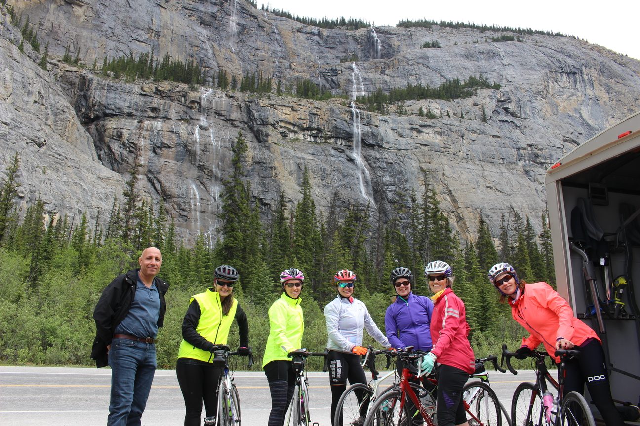
We regroup at the bottom, at the Weeping Wall, where thin waterfalls stream down the cliffs of Cirrus Mountain. In winter they freeze into the columns of ice that draw ice climbers.
Rolling into The Crossing
From the Weeping Wall it’s about 30 km of rolling hills to the end of the day. Look right for Mount Saskatchewan. You’ll probably see the van one last time at the Alexandra River trailhead parking on the left; look right from there for the glacier-topped layers of Mount Amery.
As you near Saskatchewan River Crossing, a row of peaks opens up on your right, running down the valley as far as you can see. Mount Erasmus is named for Peter Erasmus, the Palliser Expedition’s guide and interpreter. Mount Outram and Mount Sarbach are there too, and behind the resort stands Mount Wilson, named for the outfitter Tom Wilson.
Evening at The Crossing
After dinner, sit out on your deck and look south to Mount Murchison. Just after sunset, watch it glow red for a few minutes. That’s alpenglow: light from a sun that’s already below the horizon. The burnt forest on its lower slopes is from a lightning fire in July 2014. We were at the resort on tour when it happened, and you can still see the line where the burn stopped, at a rocky creek.
You’ll also have a great view of Mount Chephren, which you’ll ride under tomorrow. Mount Forbes, the highest mountain entirely inside Banff National Park, is out there too, though it’s often hidden in cloud.
Day 3
The Crossing to Lake Louise
83 km About 890 m of climbing Route map (opens in a new tab) The guest’s day 3
A climb to the highest point on the parkway, then mostly downhill to Lake Louise, past Peyto, Bow and Herbert lakes.
Straight into the first climb
Turn left out of the parking lot, roll briefly downhill, cross the bridge over the North Saskatchewan River, and the first climb of the day starts right away. Stop for a moment partway up and look back at Mount Wilson.
About 3 km into the climb, a parking lot on the right marks the trail to Mistaya Canyon. It’s a short walk (0.6 km each way) to a bridge over a deep, narrow slot that the Mistaya River has cut into the limestone.
Near the top, the Kaufmann Peaks appear ahead and to the right: two near-identical summits named for the Swiss guides Christian and Hans Kaufmann, who were brothers. We’ll be waiting at the top to cheer you in, under Epaulette Mountain and its hanging glacier.
Mount Chephren and Waterfowl Lake
Mount Chephren is one of my favourite mountains on the tour. You first see its summit near the end of day 2, you see it again from dinner at The Crossing, and from the top of this first climb it keeps getting bigger as you ride. We regroup for a snack on the shore of Waterfowl Lake, right at its base.
Collie called it Pyramid Mountain in 1897. It was later renamed for the Egyptian pharaoh Chephren, who built the second of the great pyramids at Giza, to avoid a mix-up with Pyramid Mountain at Jasper.
Bow Summit, the high point
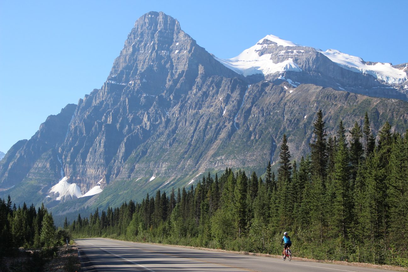
After Waterfowl Lake there are about 10 km of easier riding before the climb to Bow Summit. We park on the right just before it starts. You’ll be carrying speed off a short downhill, but look right: that’s Mount Patterson, with the Snowbird Glacier spread across its cliffs like a bird with its wings open.
At 2,070 m, the top of this climb is the highest point on the Icefields Parkway. It’s a long, steady climb rather than a steep one.
The bonus round: Peyto Lake
At the top, if the weather is good, there’s an optionally mandatory bonus round, worth an extra chocolate pretzel. Trust me, you’ll thank me later. It’s about one more kilometre uphill to the Peyto Lake viewpoint, and if it’s busy we often walk a few minutes further to a quieter spot.
The lake’s turquoise colour comes from fine rock flour washed in from the Peyto Glacier. From up here you can see almost 40 km back down the valley you’ve ridden, all the way to the glaciers on Mount Wilson behind last night’s hotel. Turn around, too, for Observation Peak. The lake, the glacier and Peyto Peak are named for Bill Peyto, one of the early outfitters who guided climbers like Collie and who later worked for many years as a park warden.
Lunch at Bow Lake
From the viewpoint we drop back to the parkway and descend about 6 km to Bow Lake. Lunch is at a quiet day-use area on the shore, away from the crowds, under the bulk of Crowfoot Mountain. Across the lake is the red roof of Simpson’s Num-Ti-Jah Lodge, built by the outfitter Jimmy Simpson, and beyond it the Bow Glacier feeds Bow Glacier Falls. This is the start of the Bow River, which flows on through Lake Louise, Banff, Canmore and Calgary.
Just south of the lake, look up at the Crowfoot Glacier. A century ago, Parks Canada says, it looked like a three-toed crow’s foot. It has shrunk so much that the shape is hard to make out now.
Downdulating to Lake Louise
After lunch it’s what I call downdulating: mostly downhill, with a few whoopsies. Bow Peak runs along your right for a long way, changing shape as you pass it, and Dolomite Peak rises on your left. Look back once you’re past it for the best view. Beyond Mosquito Creek campground and hostel there’s one cheeky little roller, with Mount Andromache ahead on the left.
Then it’s downhill again to the Hector Lake viewpoint, where the van is usually parked on the right. You’ll probably be on a roll and fly past, but stop and say hello if you want the view: Hector Lake on the right, Mount Hector on the left, both named for James Hector.
Some afternoons bring a headwind up the valley, and you’ll find yourself pedalling hard just to keep your speed downhill. Herbert Lake is the last lake before the end of the parkway.
Lake Louise
The Icefields Parkway ends at Lake Louise. We regroup and ride the last short stretch to the Mountaineer Lodge, our home for the night.
Day 4
Lake Louise to Banff
60 to 85 km About 370 m of climbing Route map (opens in a new tab) The guest’s day 4
The easy finale: the quiet Bow Valley Parkway, then the Legacy Trail into Banff, with an optional ride on to Canmore.
Before you leave Lake Louise
Mount Temple is the big mountain that dominates the view from the village. At the head of the lake itself stand Mount Victoria and Mount Lefroy, the famous backdrop to every photo of Lake Louise. The Stoney Nakoda called it the Lake of the Little Fishes. It was a Stoney guide, Edwin Hunter, who showed it to Tom Wilson in 1882, and it was later named for Princess Louise Caroline Alberta, a daughter of Queen Victoria. Its colour, like Peyto’s, comes from rock flour in the meltwater.
The Bow Valley Parkway
We leave Lake Louise, cross the Trans-Canada Highway and ride the Bow Valley Parkway, a 48 km road that Parks Canada describes as a quieter alternative to the highway. Expect gentle rolling hills, much less traffic and a good chance of wildlife.
Shortly before the halfway point, watch for a viewpoint on the right that looks across the Bow Valley to Storm Mountain. The surveyor George Dawson named it for the storm clouds that hid its summit for much of his time in the area in 1884.
Castle Mountain, the last snack stop
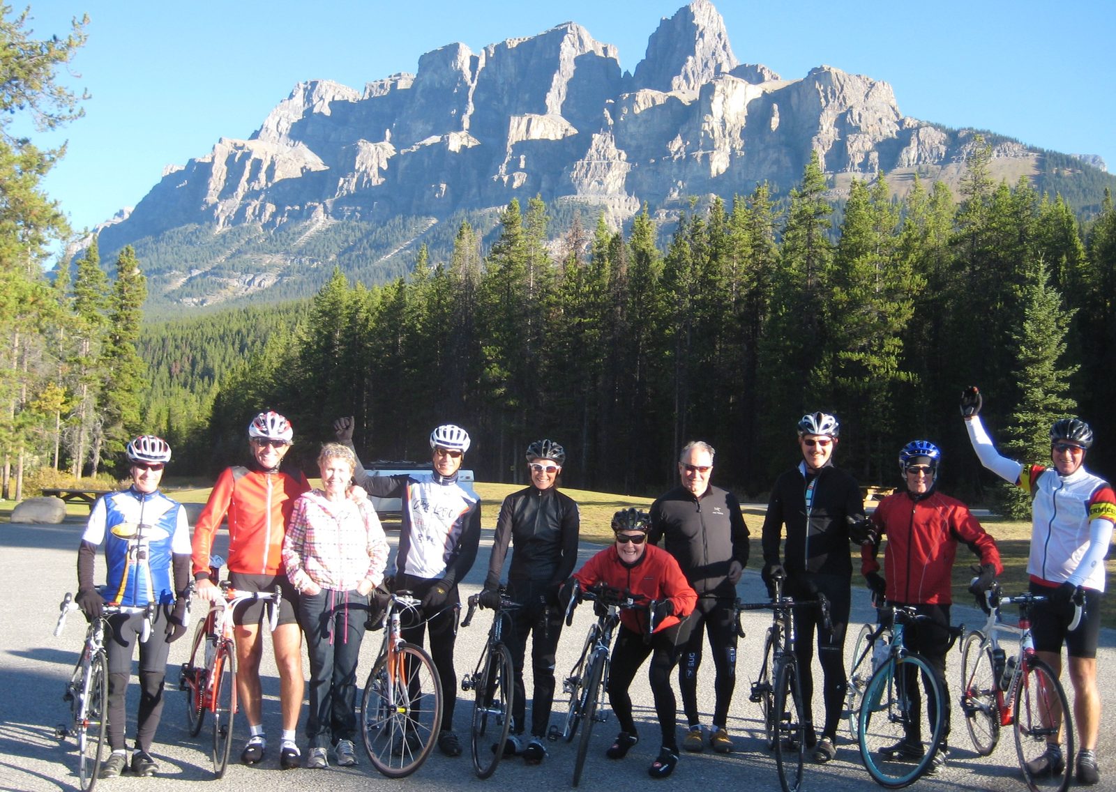
About 30 km in, roughly halfway to Banff, we stop one last time at Castle Mountain Chalets. By now you can feel the tour winding down, and one last scone or chocolate pretzel goes down well. Look right at Castle Mountain. James Hector named it in 1858 for its castle-like shape. It was renamed Mount Eisenhower in 1946 and got its old name back in 1979, when one of its peaks became Eisenhower Peak.
Nearby, a memorial marks a First World War internment camp. Parks Canada tells the story in its exhibit at the Cave and Basin in Banff: the camp opened at Castle Mountain in July 1915, moved to the Cave and Basin that November and closed in July 1917.
Vermilion Lakes and the Legacy Trail
At the end of the Bow Valley Parkway we join the Legacy Trail, a paved bike path into Banff and on to Canmore. You’ll ride out of the trees beside the Vermilion Lakes, with Mount Rundle rising over Banff. It’s named for Robert Rundle, a missionary who travelled out of Fort Edmonton in the 1840s.
Banff, or on to Canmore
The tour officially ends in Banff. If you’re done, we pack your bike and drive through town, past Cascade Mountain at the end of Banff Avenue. Its name is a translation of the Stoney name for it, the mountain where the water falls.
If you want more, ride the extra 25 km or so of the Legacy Trail to Canmore. Look for Ha Ling Peak above the valley that leads to the Spray Lakes. It’s named for Ha Ling, a Chinese cook for the Canadian Pacific Railway who climbed it on a bet in 1896, though the peak only got his name in 1997. The Three Sisters stand over the town. Then we load up for the drive home.
Jasper to Banff, fully supported
Ride it with us
Four days from Jasper to Banff with hotels, meals, park fees and the van never far away. From $2,697 per person, twin share.